
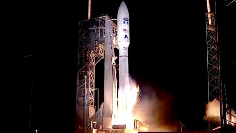
A newly launched weather satellite could save lives by better predicting extreme weather. The National Oceanic and Atmospheric Administration’s GOES-R satellite was launched from Cape Canaveral, Florida, on November 19 and will be in geostationary orbit some 36,000 kilometers above Earth. NOAA said it could “ boost the nation’s weather observation network and NOAA’s prediction capabilities, leading to more accurate and timely forecasts, watches and warnings.” NOAA said the satellite will require testing of its six instruments and will be operational “within a year.” “The next generation of weather satellites is finally here. GOES-R is one of the most sophisticated Earth-observing platforms ever devised,” said NOAA Administrator Kathryn Sullivan. “GOES-R’s instruments will be capable of scanning the planet five times faster and with four times more resolution than any other satellite in our fleet. With these new instruments and powerful new capabilities, GOES-R will strengthen NOAA’s ability to issue life-saving forecasts and warnings and make the United States an even stronger, more resilient Weather-Ready Nation.” The greater detail “will help improve hurricane tracking and intensity forecasts, the prediction and warnings of severe weather, including tornadoes and thunderstorms,’ according to a NOAA news release. “Additionally, GOES-R’s improved rainfall estimates will lead to more timely and accurate flood warnings.” GOES-R will also help the aviation industry by giving better estimates of wind strength, as well as better detection of fog, ice or lightning. One of the six instruments aboard GOES-R allows scientists to monitor lightning strikes and map them. This, NOAA says, will help track severe storms and issue more detailed warnings. “GOES-R will significantly improve the ability of emergency managers across America to prepare for, and respond to, weather-related disasters. Better situational awareness will result in better outcomes — from where to best position resources ahead of a storm to delivering more targeted information to local officials to decide if an evacuation is necessary,” said Craig Fugate, Federal Emergency Management Agency administrator. In addition to better weather forecasting, the satellite will be part of an international satellite-based search and rescue network and will be equipped with a “special transponder” that will be able to detect distress signals from emergency beacons.
Next-Gen Weather Satellite Set to Improve Forecasting


